![]()
![]()
![]()
![]()
57. Lowick
start: Ford
distance: 28 miles
OS map: 75
 A pleasant route through rural Northumberland, mostly on road with a just a couple of miles on track. The route is described from the bridge over the River Till near Ford village.
Ford Village and Castle are worth a look but you'll need to head up the hill past where our route turns R for Kimmerston. There's some interesting architecture and the castle - not open to the public - is impressive.
Turn R at the T junction just past Kimmerston and roll down to cross the River Till at Redscar Bridge. Turn L and follow this road for two miles, passing Milfield Gliding Club on the R. Turn L at Bridge End Farm and follow the track for Doddington. You pass over Ewart Park Bridge which was built in 1799 by Count Horace St Paul - who else? The bridge actually has 14 arches, though you won't notice them unless you leave the track to look.
The track heads E with good views SW to the Cheviots. It becomes a little overgrown before passing under some pylons. Follow it round to the R to reach yet another bridge over the Till and on to Doddington.
Head S from Doddington. You could follow a longer route into, and back out of, Wooler if you want but we turn L to skirt the foot of the hill round to East Horton. Go L here and the road follows the course of the Roman Devil's Causeway heading gradually uphill. As you approach Lowick you can see Kyloe Crag over to your R and you'll also get a glimpse of the sea.
There are two pubs in Lowick village, one of which you pass as you go straight across the main road heading N and still following the course of the Causeway. Turn L at the T junction, R when you meet the B6525 then L through Bowsden village. We're aiming for Duddo and you'll notice a craggy looking tower on the hill as you approach.
Take the road signed for Ford and Etal. There's a fine sandstone crag at Berryhill on the L. You can't really see it from the road, but if you want to look then it's considered polite to ask at the farm first (936 405). Don't go in the nesting season, though.
Etal village has a pub and shop. The castle is open to the public and Etal is also at one end of the Heatherslaw Light Railway which runs to, er, Heatherslaw....;-)
jb, galashiels
Download GPS data in GPX format.
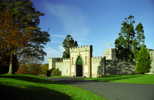
Ford Castle

Ford Village

Cheviots from Ewart Park Bridge
![]() back
back
![]() next
next
![]() home
home
![]() map and routes
map and routes