![]()
![]()
![]()
![]()
52. Gore Glen
start: Gorebridge
distance: 21 miles
OS map: 66
 Just occasionally you stumble upon a gem of a place, almost by accident. Gore Glen is one such, and it's tempting to keep it quiet...so hush and don't tell, OK?
There's a small cemetery and parking area on the A7 near Gorebridge at (346 604). The route is described from here.
Take the main road for a few yards but turn off to the R for Gorebridge and follow the road round and downhill. As the road starts to go uphill, look for a garage on the R with a green roof. Turn R as you reach it and aim for the back of some newish houses where the old Waverley rail line used to run. There's a path that runs behind the houses and under a bridge to emerge in more open countryside with views of the Pentlands ahead of you.
After about half a mile, and as you near the A7, the trail swings to the R. Turn off L here onto a smaller path, through a gate and down a steep grassy slope - you're aiming to go under Shank Bridge. Follow the path through some bushes, to the R at first and then straight on to come out into a more open grassy area. The River Gore is to your L and following near to its bank you head into bushes again, passing a small pond, down and then up a bank onto a more distinct path. This section is a little overgrown but don't be put off. The path now is a fine run through the trees to come out by a stone bridge near the junction of the River Gore and the South Esk.
The bridge was apparently part of an old coaching route to Edinburgh. There's a good path going L to follow the South Esk for a while and it's tempting to think it would go as far as Temple. I don't think it does, but perhaps someone with local knowledge could put me right? Anyway, we go straight on and head uphill from the small parking area to pass under a low bridge. [Don't ever drive down here with a bike on your roof! Ed.]
Shortly after the bridge, the road turns R but we go L down a track and follow it round to the R. Ahead, the outline of the now closed Lady Victoria pithead is prominent. The Scottish Mining Museum is in Newtongrange, on the main road and is easy to find if you want to visit. Our track meets the Gorebridge to Bonnyrigg road; turn R then almost immediately L into an industrial estate. We want to pick up the line of the railway again before it goes under the A7.
This next part of the route is a non-starter at the moment (June 2000) because of a housing development. We'll have to see how it works out, but please feel free to suggest an alternative. Maybe the simplest route is to head along the A7 to the Sun Inn...
[Go straight ahead and where the road ends, go onto some waste ground but bear R as you do so. This area is used by kids and motorbike scramblers, among others, though I think it's scheduled for 'development' so we'll have to see how things evolve. Pick a route keeping the pithead over to your R and you'll come onto the old rail line.]
[Follow the line as it goes under the A7 road bridge. As it passes along the backs of some new houses it takes on a better surface. The track stops at a sort of T junction. There's the old viaduct ahead but no access onto it. Turn R then L as you meet the road. Go downhill to the A7 and turn R to go along to the Sun Inn.]
Turn L here to go under the viaduct and start to climb gently. Go straight across at the crossroads by the church with the unusual tower.
After a mile turn R just after where the road swings to the L. This is a straight road for 3 miles or so, past Stonefield Farm. The road turns to a track just by a cattle grid. Follow this dirt track towards Cauldhall and Fullarton. The country changes now and has a more 'upland' appearance with open views to the Pentlands and south to the Moorfoot hills.
At Fullarton Farm go R to pass it and follow the track round to meet the B6372. Turn L. In a mile or so take the R turn at a sharp corner which leads down towards Gladhouse Reservoir. Take the L turn after a mile to follow around the reservoir. At (309 542) turn L; the road rises towards some woods. turn R at the bottom of a dip, aiming for Middleton, and R again after a mile or so.
There's a short hill and at the top you'll see an old lime kiln over to the L. A track leads in front of it and on into some woods; you'll need to lift the bike over a couple of gates here. An easy roll now down to the A7 and back to the cemetery.
jb, galashiels
Download GPS data in GPX format.

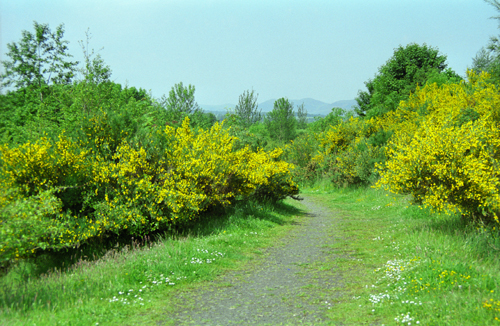
Gore Glen, Gorebridge

Lady Victoria pithead, Newtongrange

Gore Glen, Gorebridge
old railway near Gorebridge
![]() back
back
![]() next
next
![]() home
home
![]() map and routes
map and routes