50. Beamish
start: Blaydon
distance: 31 miles
OS map: 88
 This is a real treat of a route. It takes in parts of the C2C, Beamish open air museum, the oldest railway in the world and much more. Barely more than a mile in total is on road; for the most part we're on good surfaced tracks and bridleways. Enjoy!
Start at the Swalwell Visitors' Centre just behind Blaydon Rugby Club (197 620). You could start at the Metro Centre or even the middle of Newcastle; in which case follow the Keelmans' Way on the S side of the Tyne to bring you round to the start of the Derwent Walk at Swalwell.
Access to the Derwent Walk - which for the most part follows an old rail track - is just behind the Visitors' Centre. After just over a mile you're looking for a track off to the left through the woods. It's signed for 'Clockburn Lonnen' and heads upwards, steeply at first, but the gradient soon eases. Turn L onto an unsurfaced road which takes you up to a T junction.
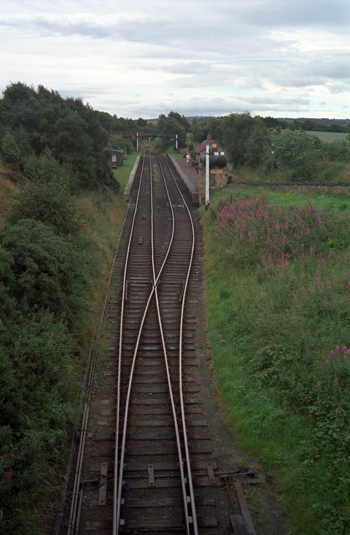
Turn R and go up the hill for about half a mile. Just as you reach a pub on the L there's a bridleway signed for Sunniside. It goes across open country then winds round the backs of some houses to meet a road. Go straight across on a path signed for 'Tanfield Railway'. The railway is said to be the oldest in the world, used originally to bring minerals down to the Tyne. It's been restored and steam trains run a regular service - a popular feature of the railway is Causey Arch, a bridge constructed over a gorge in spectacular surroundings.
When you reach the railway turn R to follow it. After a short distance, cross the line via a gate and follow the path on the E side to Tanfield Station. Cross the main road and head off down a track signed for 'Birkheads Lane'; this soon turns into singletrack and is, in fact, the course of yet another railway. When you reach a road go straight across. At the second road turn R and go downhill for a while until you come to a L turn for Kibblesworth. Don't take it but, instead, turn R here on a track which goes through some woods then down to meet a road at Beamish Hall. Turn L, go up the hill and you're now at the entrance to Beamish Museum.
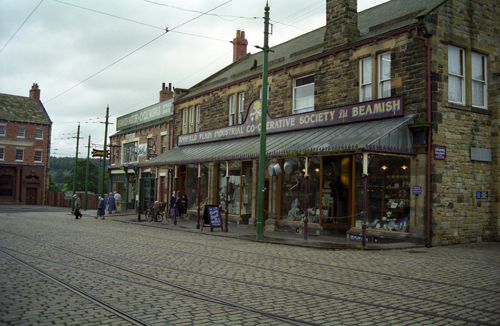
To do Beamish Museum justice you really need to spend some time there. The entrance fee entitles you to use the trams to get from one part of the museum to the next. There's a lot to see so allow plenty of time if you're going in.
Head towards the main road, passing a pub over on your L. You're looking for a path on the L down to the Consett and Sunderland Cycle Route, again an old rail track. Turn R to pass under the bridge and you'll not fail to miss the sculptures of browsing cattle made out of old mechanical parts. There are more sculptures on the route but better to discover them for yourself.
At Annfield Plain cross the road by the supermarket but after a few yards the route leaves the rail track through a gap in the stone wall. Follow along the road and you'll come across a newly built bridge over a main road. Shortly you come across an ornamental pond with some industrial units over to the R. Turn R on the road then, almost immediately L on a path through some shrubbery. The track parallels a main road for a while before going through some 'S' bends to emerge at a roundabout. Aim for the car park of the Jolly Drovers pub to pick up the track again to Leadgate.
Follow the track alongside some playing fields; we're fairly high up now and there are extensive views to the S and to the Pennines. Cross some waste ground and a road to head for a roundabout and yet more sculptures. Past these and down to Lydgetts Junction - the smelter wagon - where the Waskerley Way, the Derwent Walk and the Lanchester Valley Walk all meet.
Turn R onto the Derwent Walk, heading for Consett. Cross a main road then you're up on an open grassy crest which leads along through the edge of Consett, past a cemetery and onto the old rail track. From here it's an absolute breeze for ten miles back to Swalwell, gently downhill all the way and crossing several viaducts. There's a slight deviation when you get to Rowlands Gill. Take the footpath on the R side of the road - it's well signed - then rejoin the rail track just past a garage.
All credit should go to those councils and other organisations who had the foresight to appreciate that these rail tracks - even when closure is forced upon them - are indeed an asset to be cherished, and not a commodity to be sold off for private gain.
jb, galashiels
Download GPS data in GPX format.

Tanfield railway

sculpture near Beamish

Beamish Museum